Rob Gordon will present 35 years .. chasing the World’s Greatest Anomaly
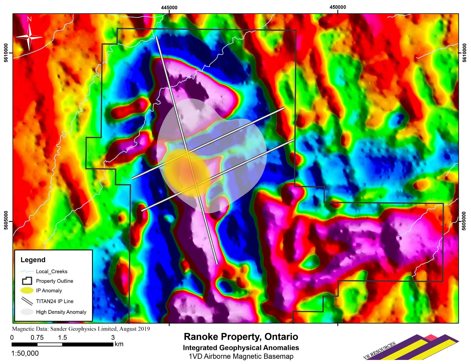
September 17, 2019, Vancouver, B.C.: VR Resources Ltd. (TSX.V: VRR, FSE: 5VR; OTCBB: VRRCF), the “Company”, or “VR”, is pleased […]
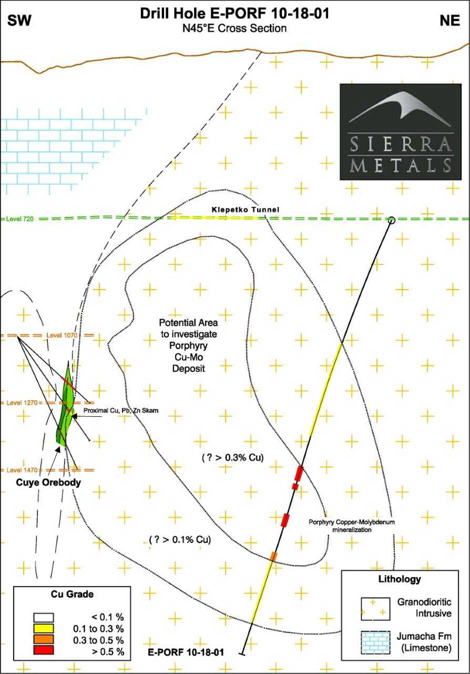
SIERRA METALS CONFIRMS PORPHYRY MINERALIZATION AT ITS YAURICOCHA MINE IN PERU, POSITIVE RESULTS INCLUDE 22 METERS OF 0.46% COPPER AND […]
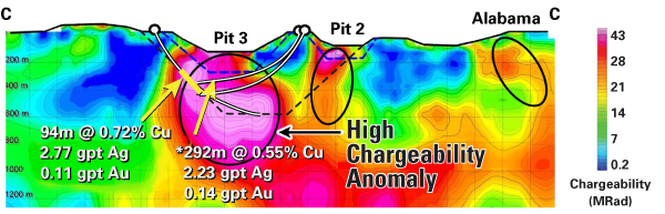
Galway Metals Drills 1.2% Copper Over 7.1m at Newiska, Quebec; New TITAN Targets and Awards Incentive Stock Options Released: […]
The recently renamed Galan Lithium (ASX-GLN) – formerly Dempsey Minerals – is preparing to commence its much anticipated geophysical surveys […]
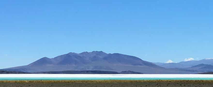
September 6th, 2018, Lexi Announces Final Geophysical Results are Positive on Over 36,000 Hectares of Brine Discoveries at Antofalla Salar […]
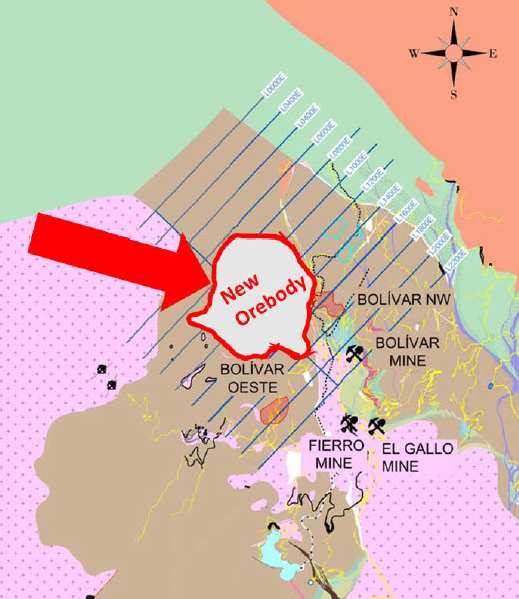
SIERRA METALS CONFIRMS NORTHERN EXTENSION OF THE BOLIVAR NORTHWEST OREBODY CONTAINING AN AVERAGE GRADE OF 1.37% COPPER AND AN AVERAGE […]

SPARTAN MT Anomaly: A New Discovery TORONTO, March 27, 2018 (GLOBE NEWSWIRE) — North American Palladium Ltd. (“NAP” or the “Company”) (TSX:PDL) (OTC PINK:PALDF) […]
June 28, 2018 06:30 ET | Source: Galway Metals Inc. TORONTO, June 28, 2018 (GLOBE NEWSWIRE) — Galway Metals […]