

Minto Metals Reports Anomalies And New Exploration Targets From Magnetotellurics Survey WHITEHORSE, YT, Dec. 20, 2022 /CNW/ – Minto Metals Corp. (“Minto” or […]
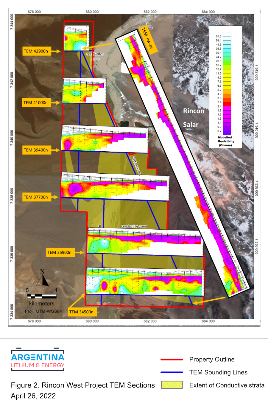
Argentina Lithium Announces Positive Results from Third and Fourth Drill Holes at Rincon West October 25, 2022 View PDF Vancouver, […]
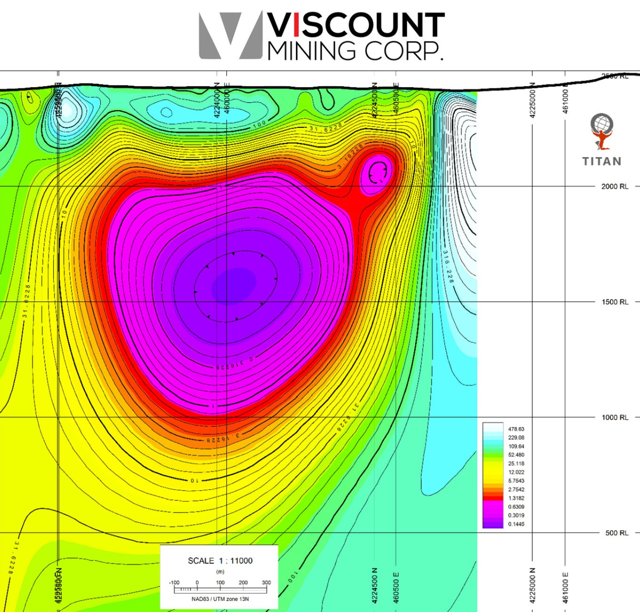
Viscount Mining TITAN MT Survey Confirms Significantly Large Conductive Anomaly Indicating Likely Porphyry at Silver Cliff, Colorado TSX.V: VML […]
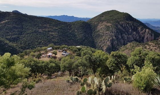
Geophysical imaging of the Healy property was achieved with deep-seeing Titan™ IP and MT surveys (induced polarization and magnetotellurics), transecting […]
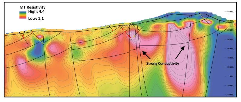
TSX.V: VIPR www.silverviperminerals.com Mr. Stephen Cope reports: Quantec Geoscience Completes TITAN MT Deep-Penetrating Geophysical Survey at La Virginia Drilling at […]
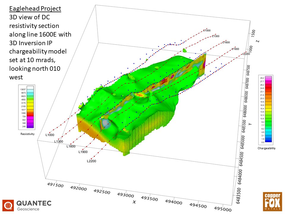
February 1, 2022 Calgary, Alberta–(Newsfile Corp. – February 1, 2022) – Copper Fox Metals Inc. (TSXV: CUU) (OTCQX: CPFXF) (“Copper Fox” or […]
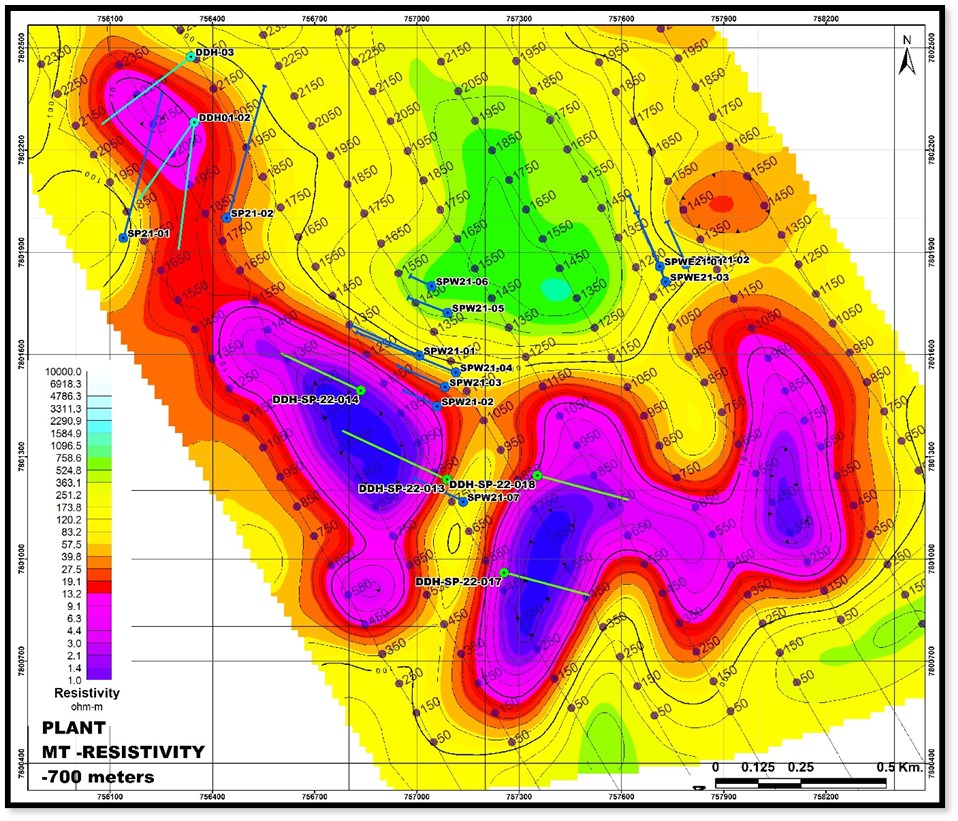
TSX.V: APM www.andeanpm.com Mr. Simon Griffiths reports: Targeting San Pablo Porphyry with 15,000 Meters Toronto, Ontario–(Newsfile Corp. – February 7, […]

Taseko Mines (TSX: TKO) announced on Tuesday that its Gibraltar mine produced 34.5 million lb of copper plus 600,000 lb […]
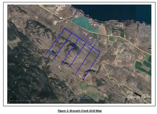
RECHARGE RESOURCES TO COMMENCE EXPLORATION AT BRUSSELS CREEK Vancouver, B.C. Canada: September 7, 2021 – Recharge Resources (RR: TSX-V) (“Recharge” or […]
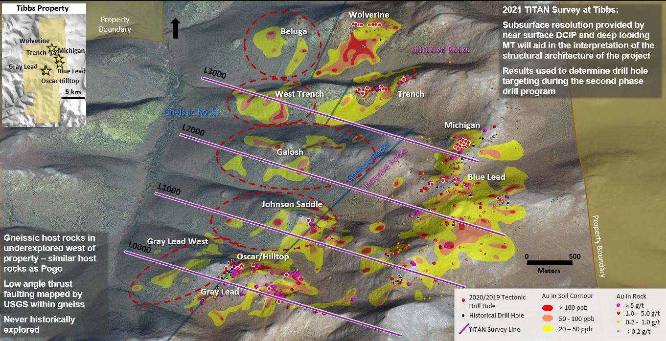
VANCOUVER, B.C., July 20, 2021 – Tectonic Metals Inc. (TECT: TSX-V; TETOF: OTCQB; T15B: FSE) (the “Company” or “Tectonic”) today announced the commencement […]