
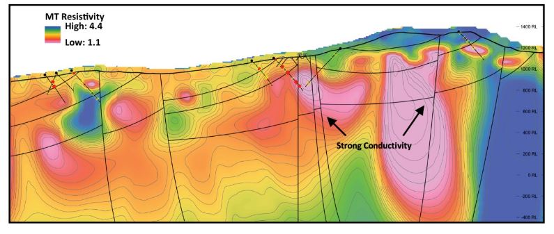
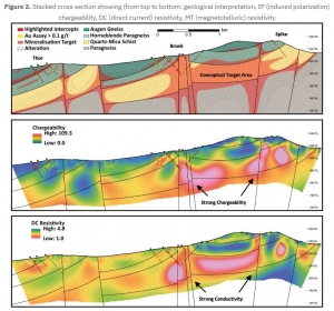
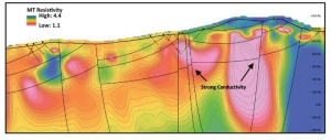
Geophysical imaging of the Healy property was achieved with deep-seeing Titan™ IP and MT surveys (induced polarization and magnetotellurics), transecting five kilometers across the three target areas where drilling was conducted. The surveys were carried out towards the end of the field season due to contractor availability. The IP and MT surveys, which imaged up to 800 meters and 4 kilometers depth respectively, support the presence of shallowly dipping, east-verging architecture with mineralisation occurring along low angle thrust faults and steeper cross-cutting fault corridors. Broad zones of disseminated sulfide and strong alteration are well-defined in the chargeability and resistivity data with zones of combined high chargeability and low resistivity (high conductivity) correlating well with mineralised intercepts from the 2021 drill program. The imaging of additional strongly conductive and chargeable zones, between drilled prospects, highlight significant exploration targets which warrant follow-up drill testing.
No responses yet