Jeff Nichols 1964 – 2018 It is with heavy hearts that we share the sad news of the […]
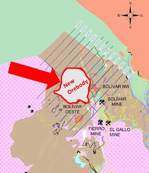
SIERRA METALS CONFIRMS NORTHERN EXTENSION OF THE BOLIVAR NORTHWEST OREBODY CONTAINING AN AVERAGE GRADE OF 1.37% COPPER AND AN AVERAGE […]

Advances in Deep Electrical Earth Imaging – Implications for Improved Targeting and Planning for Exploration 2:20 PM – 2:40 PM […]

SPARTAN MT Anomaly: A New Discovery TORONTO, March 27, 2018 (GLOBE NEWSWIRE) — North American Palladium Ltd. (“NAP” or the “Company”) (TSX:PDL) (OTC PINK:PALDF) […]
June 28, 2018 06:30 ET | Source: Galway Metals Inc. TORONTO, June 28, 2018 (GLOBE NEWSWIRE) — Galway Metals […]
Mine site geophysics and geology: a high-stakes game of truth or dare. Mr Peter Holbek (VP Exploration – Copper Mountain […]

Rob Gordon, P.Eng., Geophysicist will present at the upcoming Toronto Geological Discussion Group – Innovation Symposium on April 3rd, 2018 […]
Rob Gordon of Quantec will be presenting on Thursday April 5th at the Northwestern Ontario Prospectors association meeting. Time of […]
