

(Sept 16-20) Robert Gordon recently presented “Emerging deep penetrating technologies for Exploring under cover”. Visit “Reference” section on website to […]
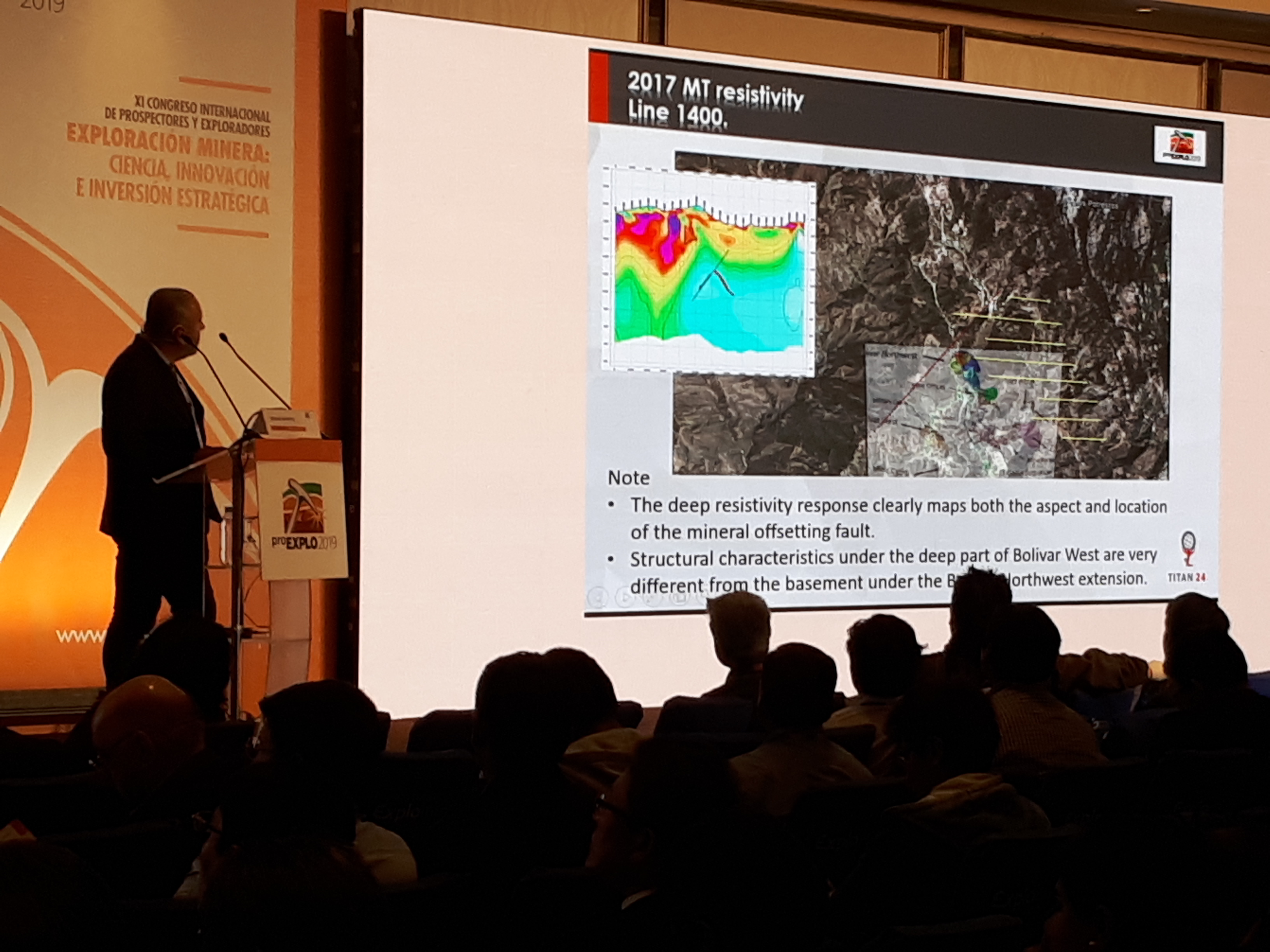
Correlations in geological model and Titan 24 DCIP_MT at the Bolivar skarn mineralization, Mexico Download Presentation

New approaches to drill targeting are helping companies discover more. Download Presentation
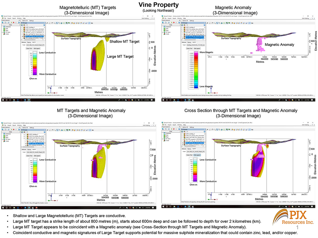
Toronto, Ontario – January 7, 2019 – Magnetic geophysics, Magnetotelluric (“MT”) geophysics and Gravity geophysics all support the potential that a […]
8:40 am, Weds May 22 Deep Exploration Imaging Meeting the challenges of decreasing discovery rates through improved drill targeting. By […]
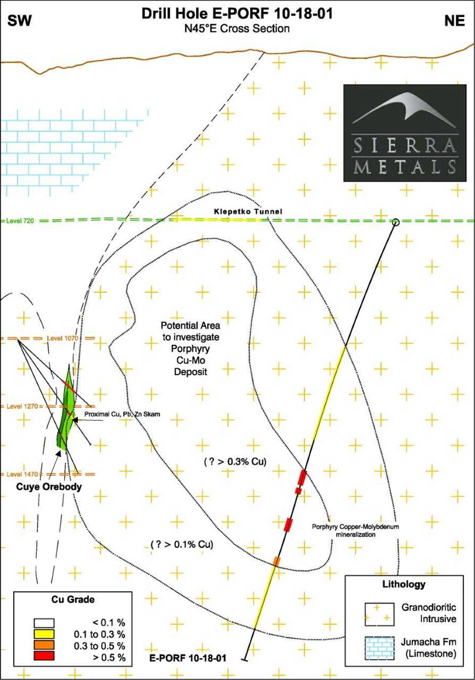
SIERRA METALS CONFIRMS PORPHYRY MINERALIZATION AT ITS YAURICOCHA MINE IN PERU, POSITIVE RESULTS INCLUDE 22 METERS OF 0.46% COPPER AND […]
Find out how leading deep imaging technology is helping explorers make discoveries and effectively target the subsurface with better drilling […]
Galway Metals Drills 1.2% Copper Over 7.1m at Newiska, Quebec; New TITAN Targets and Awards Incentive Stock Options Released: […]
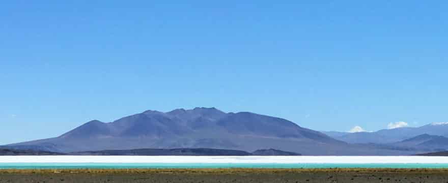
The recently renamed Galan Lithium (ASX-GLN) – formerly Dempsey Minerals – is preparing to commence its much anticipated geophysical surveys […]