 Title: Hidden (Gold) Hill Deposit 3D Exploration
Geology: Low Sulfidation Gold
Client: Sunrise Resources
Technology: ORION 3D
Location: Nevada, USA
Sector: Mining
Challenges
Sunrise was interested in detailing the resistive nature of the low sulphidation deposit to highlight the deposit zone characteristics and to better map the local region for similar target types. This Low-sulfidation gold-silver deposit is defined as a chargeable but resistive geophysical target.
Solutions
To provide detail on the complete land package, an ORION 3D DCIP survey was utilised. This survey collected data with one contiguous large ORION 3D layout.
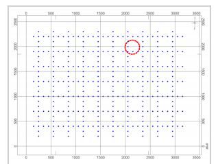
A 10×7 grid of DRM Sites was chosen as the survey geometry, with a spacing of 300 m in the north-south and eastwest directions (Figure ).
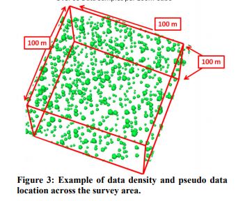
A total of 420 receiver diploes were deployed simultaneously. Current injections for the pole-dipole survey geometry of the DC/IP component were completed every ~100 m in east-west and north south directions. Additional current injections were taken outside the survey grid. In total 596 injection points were completed over the course of a 10 day survey campaign.
Highlights
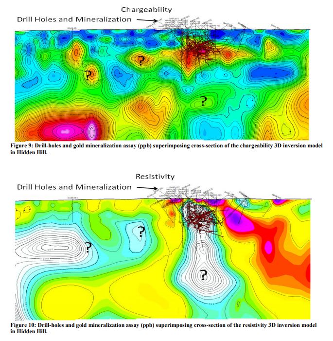
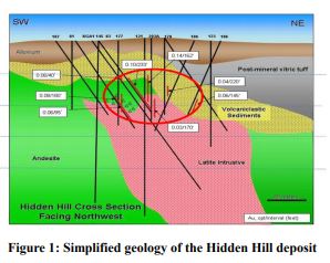
The Hidden Hill mineralization zone has been subject to a large amount of drilling to map and evaluate gold-silver mineralization grades. The existing drill-holes and their gold assay grades projected on to the chargeability and resistivity cross-sections in Hidden Hill area are illustrated in Figure 9 and Figure 10, respectively. It is evident that the high grade gold area displays a close correlation with the elevated chargeability zone. This correlation in conjunction with the resistivity anomaly associated with the Latite Intrusive dike provides a guideline to identify locations with similar geophysical signatures across the survey area as potential targets. In Figure 9 and Figure 10 a few potential targets of this kind have been marked for further exploration.