Mine Site Imaging Services
QUANTEC MINE SITE SURVEYS
Mine site surveys can save money and they can make money
Quantec surveys around active mines make sense. The resulting geophysical models can help extract additional value from the mine.
- Delineation surveys to highlight productive zones and extend mine life
- Near mine exploration surveys to identify nearby targets to feed infrastructure
- Condemnation surveys for mine planning
- Target production drill holes
- Add information to geometric and volumetric analysis
- Pre tailings pond planning
- 4D tailings monitoring

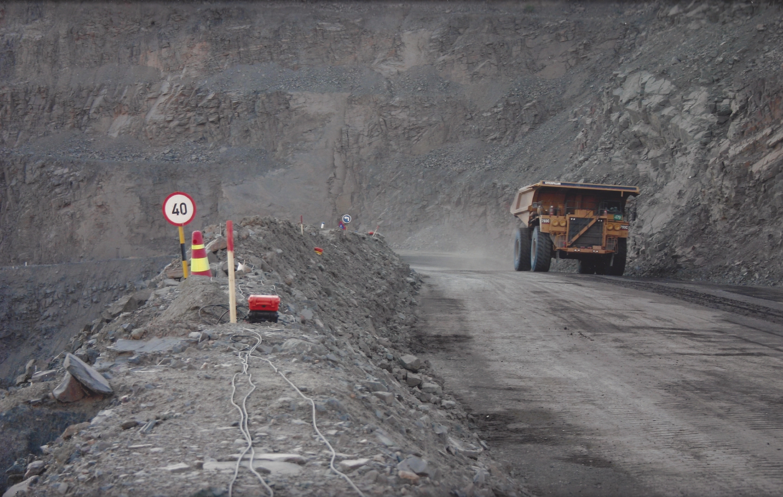
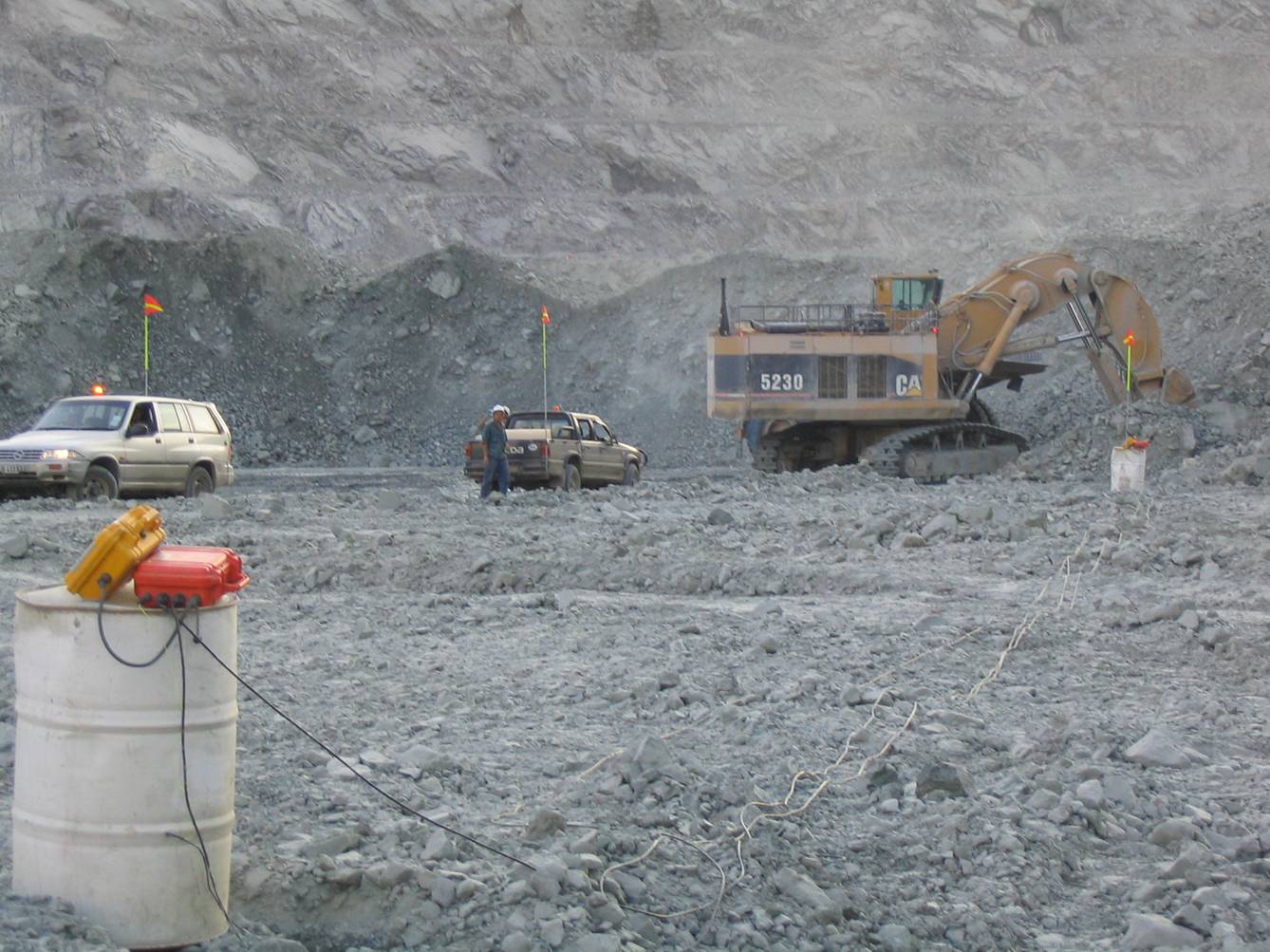
Haul roads, cultural noise, open pits and power lines are always challenges when attempting to collect quality data
Mine site surveys are challenging
Exploring in and around mine sites is not easy. Extreme cultural noise ‘in the shadow of the headframe’ are challenges that include:
- Electromagnetic noise – power lines, generators, etc.
- Scheduling around mine production
- Access issues – how to place sensors, where?
- Health and Safety
Traditional mineral exploration techniques have proven to be unreliable tools when faced with mine site challenges
Tangible solutions for drill planning and mine planning
Quantec mine site technology
Quantec has developed new and innovative, deep penetrating technology for providing subsurface imaging in the mine environment. Now technology allows us to image more thoroughly than ever before in and around the mine, and quickly so potential disruptions to operations are minimalised. The unique data acquisition techniques of TITAN, ORION 3D and SPARTAN MT provide more reliable, accurate information for mine planning. These technologies have the very best digital signal processing, noise reduction, rapid sampling and sensitive signal monitoring. Quantec’s proprietary technologies have proven superior for indicating the location, volume and shape of minerals for drill targeting around mines.
Sophisticated technology
- Data redundancy improves signal-to-noise ratio
- Full waveform signal collects all information
- Proprietary digital signal processing methods extract subtle signals
- Excellent noise rejection routines
- Full 3D acquisition and modeling captures geological complexity
The TITAN deep imaging technology has executed surveys at over 60 mine sites providing several key parameters of the subsurface for a variety of purposes including, ground condemnation, drill planning and exploration. Learn more about TITAN on the TITAN PAGE.

Proven deep imaging technology for the mine
Mine site experience
Quantec has the proven experience and technology to conduct mine site surveys.
- Highly experienced personnel familiar with mine site operations
- Proven ability to adhere to stringent mine site HSE regulations
- 60+ mine site surveys
- Over 22 years of mine site survey experience
- Many successful case studies
Our Mine site surveys provide results
Critical decisions regarding how and where to mine and where not to drill can be made prior to expensive and extensive delineation drilling or condemnation drilling. In this example a TITAN survey was carried out over existing pits and a large new discovery of mineable material was achieved, thereby facilitating the design and development of a completely new pit.
Copper Mountain – improved pit designs
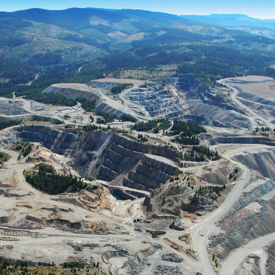
Copper Mountain, BC. TITAN survey completed over existing pits.
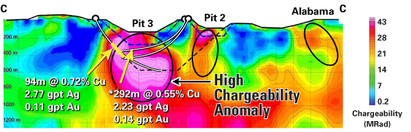
TITAN 24 IP survey results showing enormous anomaly below existing Pit 3 with corroborating excellent drill results.
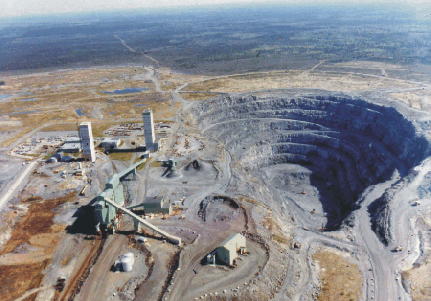
Kidd Creek – cost saving drill planning
At Kidd Creek Copper mine, a survey indicated a large barren zone in the immediate vicinity of the mine. This region had been extensively drilled (blind) over the year. Had the survey been done first, it is estimated the company would have saved over 20 million dollars in unnecessary drilling costs.
Aerial view of the Kidd Creek Mine, Timmins, Ontario
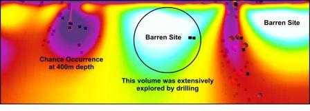
Survey results near mine (note region in circle; based on signature of mine this would represent a barren zone.
Drilling over the years near the mine. Many holes tested barren rhyolite horizon.
Jwaneng – delineation improvements
Despite the heavy cultural noise of the Jwaneng diamond mine, Quantec discovered two new pipes indicating presence of kimberlite bodies at 800 m in Botswana and imaged the sides of pipes to great depths thereby focusing drilling and mining.
Survey lines were completed right through the active pit
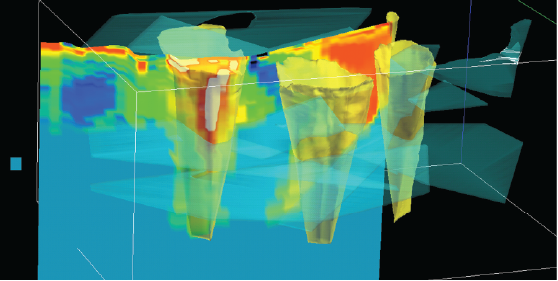
Resistivity model below pits show overall shape of ore bodies to depths of 800 m
View mine site photo gallery


")
")


Visit our PROJECTS page for more excellent examples of technology applications leading to cost savings and discoveries at mines.
Quantec mine site survey experience
Quantec has a proven track record of successful mine site surveys. This is a partial list of projects.
- Kemess (Northgate)
- Jwaneng (DeBeers)
- Tenke (Freeport)
- Hidden Hill
- Oyu Tolgoi (Entree Gold)
- Fortitude (Newmont)
- Goldstrike (Barrick)
- Black Fox (Apollo Gold)
- Lac des Iles (North American Palladium)
- Ren (Centerra Gold)
- Red Lake Mine (Goldcorp)
- Brunswick and Half Mile (Noranda)
- Voisey’s Bay (Vale Inco)
- Levack and Norman (FNX Mining)
- Chelopech (Dundee Precious Metals)
- Nickel South Rim (Falconbridge)
- Boroo (Centerra Gold)
Curious about how our surveys can help out at your site? Contact our experienced mine site team to discuss your site. We are more than happy to present additional examples in more detail and to discuss the challenges that may be involved at your site.
See how deep high resolution imaging can contribute to improved drill and mine planning.