Deposit characterization and exploration
Title: Porphry mapping
Geology: Epithermal Porphry
Client: Seabridge Resources
Technology: SPARTAN MT
Location: British Columbia
Sector: Mining
Challenges
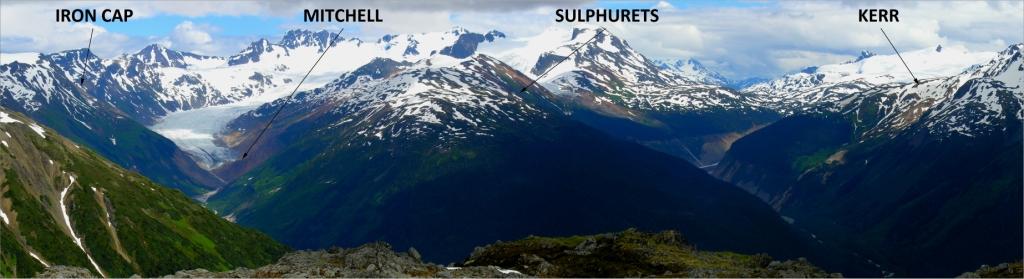
Northern BC is a rugged part of the world. Traditional exploration and drilling are very expensive. In addition, geophysical methods requiring continuous/contiguous lines are challenged, as access can be very difficult. The elevation range within this area was between 520 m and 2300 m ASL, with extremely steep slopes. The client required an operationally feasible geophysical method that showed the previously discovered KSM deposits, and could be used to guide further exploration.
Solutions
The SPARTAN MT survey provided a portable and flexible solution consisting of 175 individual SPARTAN sites covering an area of 11 km x 7 km. The system’s autonomous loggers allowed the crew to adjust recording station locations to make best use of safe access routes in the difficult terrain.
Highlights
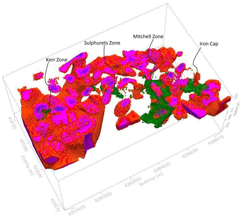
Large scale regional resistivity model
The survey successfully identified at least three high priority targets with high resistivity gradient areas consistent with deep faults and shear zones. The resistivity imaging provided key information and indicated deep structural controls and potential alteration zones, and allowed the existing KSM deposits to be integrated into an extremely useful regional 3D resistivity model with correlation to mineralisation highlighted.

