3D MT Inversion Reveals Subsurface Structures in Volcanic Region
Broad scale and deep imaging based on a regional set of MT data was required.
The data acquisition component of this survey was straight forward, and the data was of high quality. The true solutions were achieved at the interpretation stage. Quantec’s Interpretation department provides a broad range of geophysical solutions for clients for data handling and interpretations. Quantec has specialised proprietary software for 2D, 3D, and joint parameter inversion to deliver appropriate solutions. In this case several different techniques were integrated to meet the client’s exploration objectives.
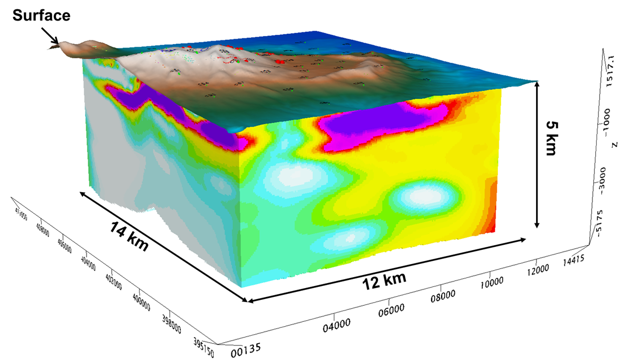
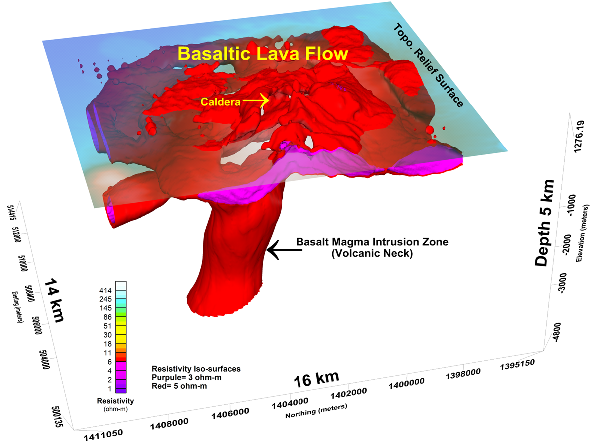
A large data interpretation cube was produced for the project. This allowed the client to visualise in 3D their complete land package stretching 14 x 12 km. The data was interpreted to depths of 5 km. Iso-shells were built around resistivities that represented particular rock units. The complete magma chamber was highlighted for this project, leading to an improved understanding of the geology, and in particular the nature and probable locations of geothermal reservoirs.
Title: 3D MT Inversion
Geology: Volcano
Client: Confidential
Technology: SPARTAN MT
Location: Undisclosed
Sector: Mining